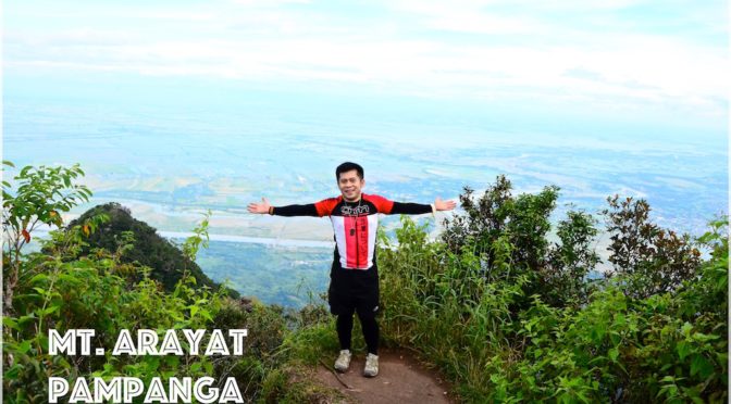
MT. ARAYAT TRAVERSE
Arayat and Magalang, Pampanga
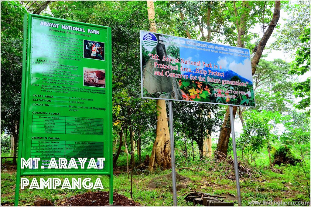
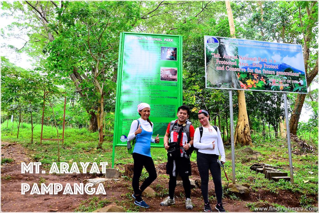
Entry point: Brgy. Ayala, Magalang, Pampanga
Exit point: Brgy. Juan Bano, Arayat, Pampanga
LLA: 15.2067N, 120.7441E, 1030 MASL
Days required / Hours to summit: 1-2 days / 5 hours (NP) 8 hours (SP)
Specs: Major climb, Difficulty 5/9, Trail class 1-4 (10kms)
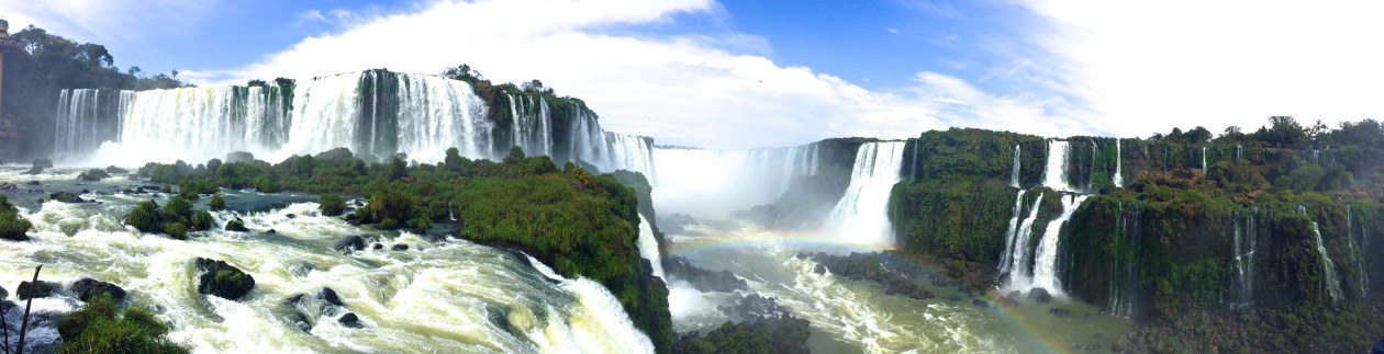
Features: Tropical forest, scenic views of Central Luzon
*from Pinoy Mountaineer
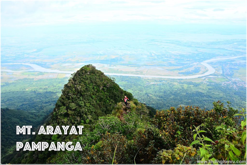
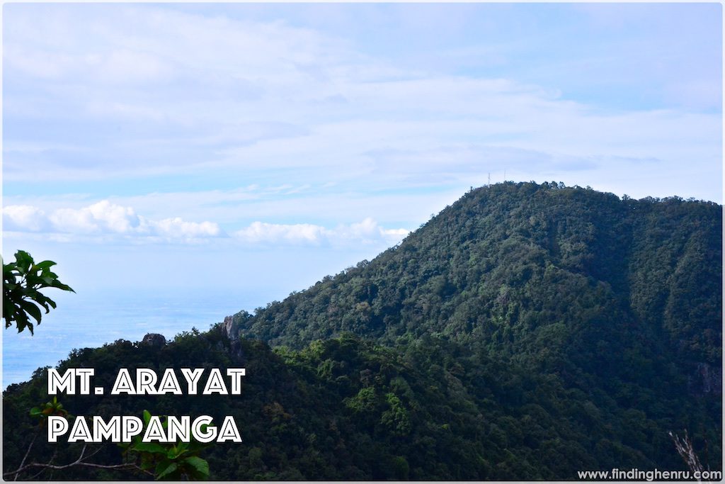
Mt. Arayat is the lone mountain in the province of Pampanga. When driving at NLEX or SCTEX, the beauty of Mt. Arayat never fails to catch your attention. There are two peaks: North and South. Usually when doing the traverse, you will start at the North Peak then to the South before going down the exit point. The hike usually takes 10-12 hours to complete the traverse, that is depending on the weather condition also. During rainy season, expect a somewhat difficult trail.
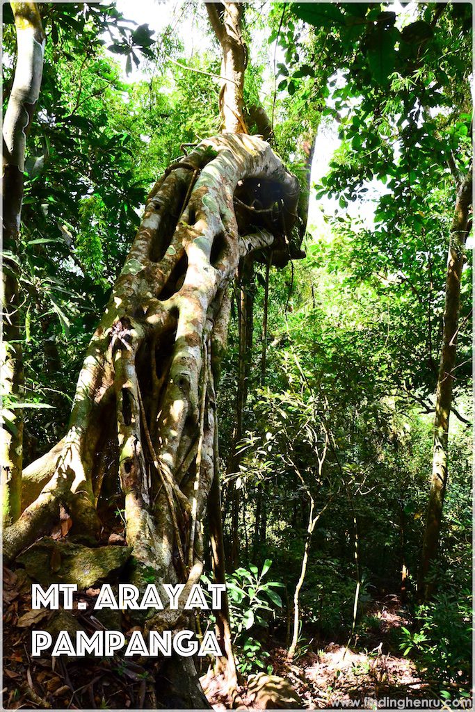
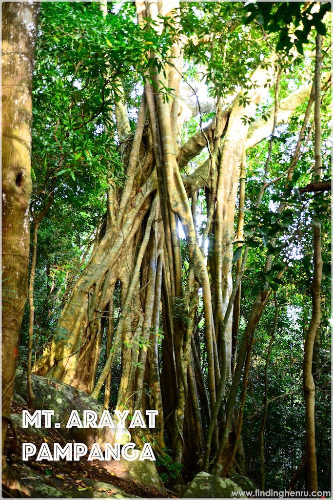
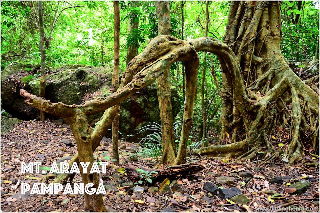
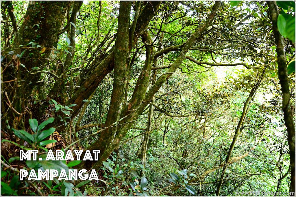
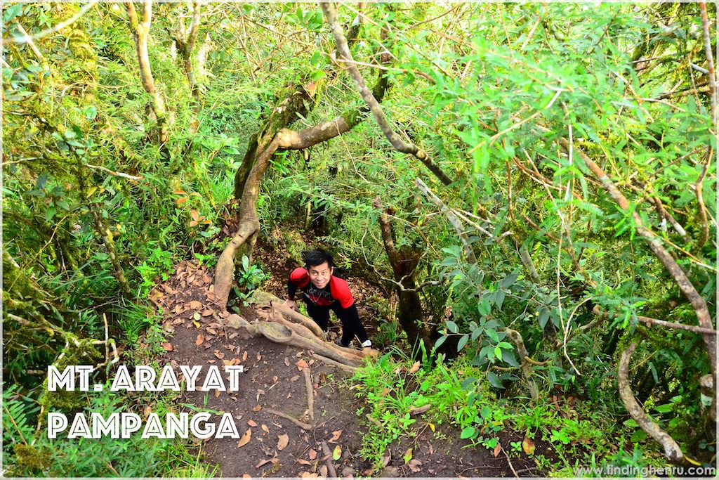
Mt. Arayat also offers diverse flora. The trail is forested so as not to worry if you don’t have sun protection. Along the way, huge trees and rocks are some of the attractions for photo opportunities. Approximately 90% of trail to the North peak is about 40-60 degrees assault. It takes 4-5 hours of hike from jump-off to North Peak.
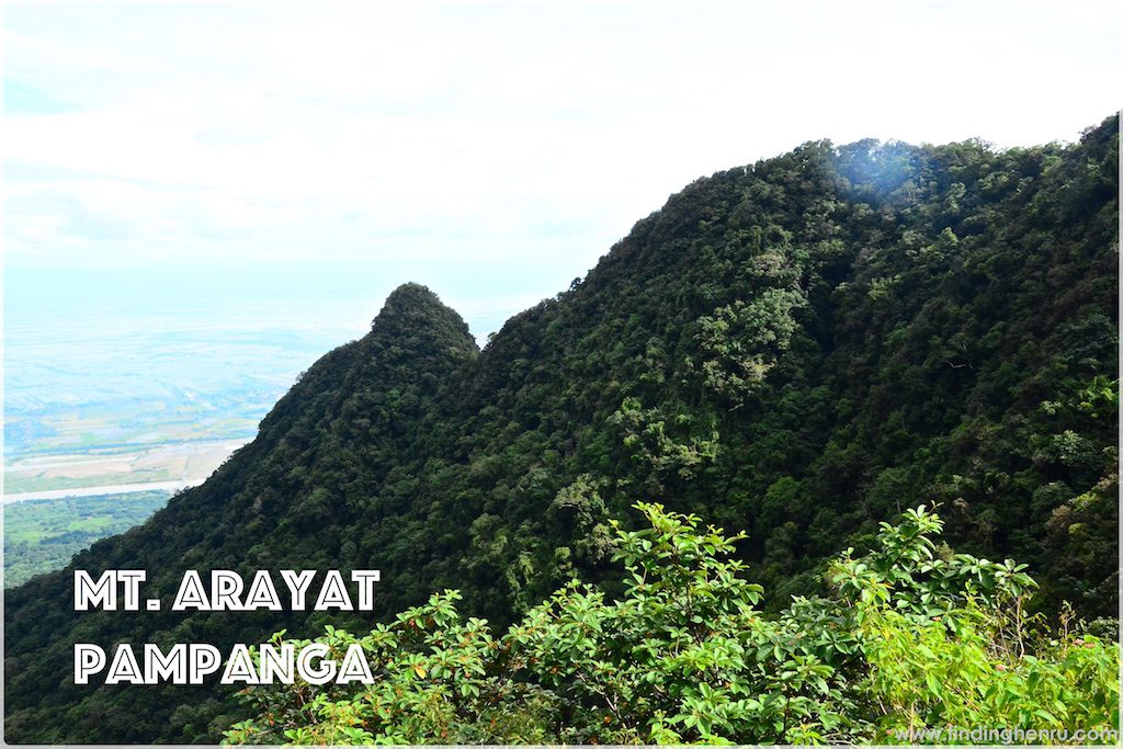
The traverse will also take 1.5-2 hours bracing the challenges of walking through the forest, a roped segment and a challenging steep climb to the South Peak. Along the way, there is a viewpoint wherein you can be able to take pictures above the rock. That is the only portion that is open where you can have a glimpse of the surrounding towns of Pampanga.
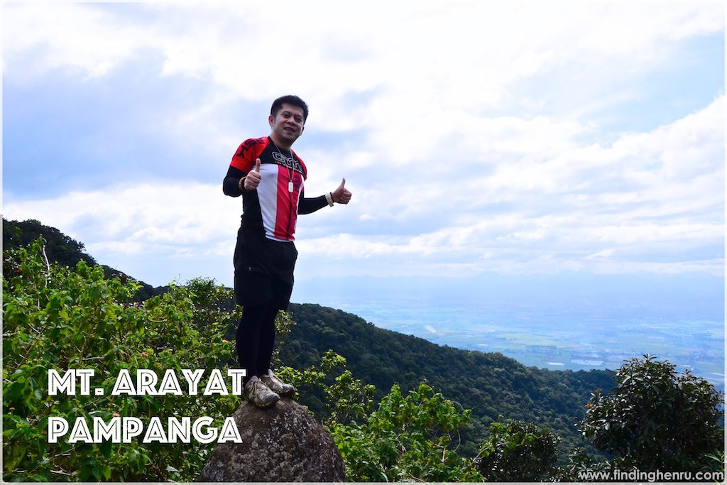
At the South Peak, there is a good spot for photo opportunities wherein you can have a wonderful view of the Pampanga River and the rest of the province. You can also do your signature “buwis-buhay” pose at the cliff. The trail going down is approximately 60-70% descend and the remaining portion is a walk at the local farms.
Itinerary
October 25, 2016
05:30am – Depart Manila for Arayat
07:30am – Arrival at Spring Resort in Arayat, take a trike to the jump-off at Magalang, Pampanga
08:30am – Start Trek
12:30pm – Arrive at the North Peak, lunch, rest
01:00pm – Resume hike
02:30pm – Arrive at the South Peak, photo ops
03:00pm – Start descend
05:45pm – Arrive at the exit point in Arayat, Pampanga
We usually have a weekday climb with my BFFs Philamer and Feby. Unfortunately, Feby is out of the country for work, we have to postpone climbs until Feby is around. This time, we have a weekday climb since another BFF Gladys is in town for a business trip. As part of entertaining Gladys is to showcase Luzon mountain and we agree on Mt. Arayat to be the venue. It is a major climb by the way, it’s the third mountain of Philamer and Gladys too. But its their first major climb. We are all excited for our itinearary.
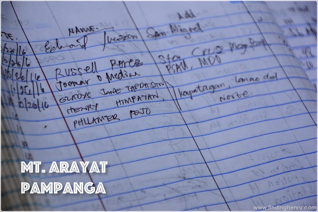
Guide fees are quite expensive: Php 1,500 for traverse and Php 800 for backtrail. Since we’re all set for it, we all bet for the traverse.

After parking the car at the resort in Arayat, we take a tricycle bound to the jump-off at Magalang, Pampanga. It’s quite far that we have to pass by several towns going to the other side of the mountain. At the foot of the mountain is the Station of the Cross before getting to the registration area. After settlement of the fees, we start our trek to the North Peak.
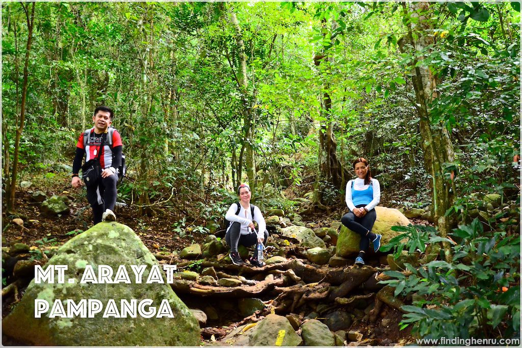
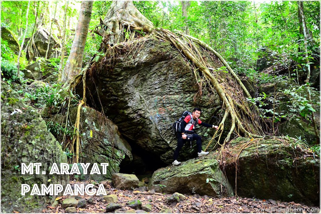
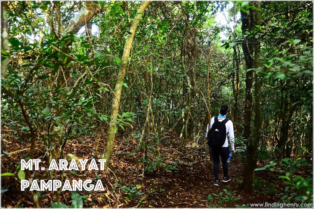
There are markers along the way, so if it is possible to climb without a guide, you will never get lost at all. I am amazed on the trail, it’s forested and rich. There are also huge rocks along the way and gigantic trees with big roots for photo opportunities. I never get tired of feasting my eyes on its beauty.
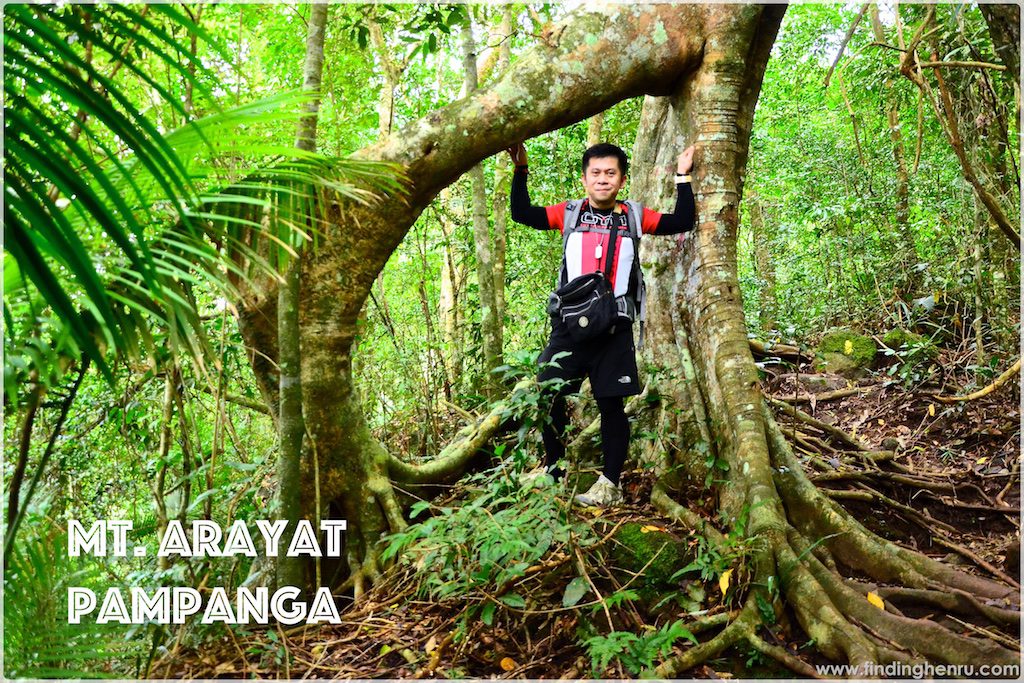
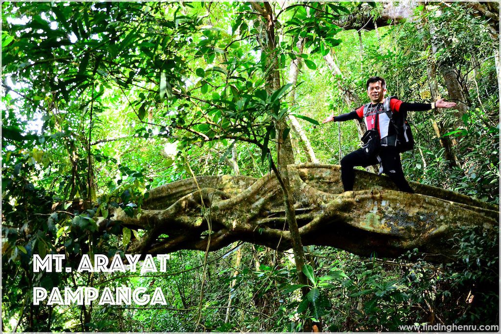
Continuing our hikes, we also have several stops to savor the beauty of the place. Not to miss also picturesque spots for our capture our poses. I even have to climb the huge branch of one tree for a wonderful pose. While enjoying the view, we did not notice that we are already at the North Peak. There is a ranger’s camp at the North Peak. As per our guide, we can also camp at the open area at the North Peak.
We have a 30 minute break for lunch and rest before resuming our hike. While having a break, our guide also shows us the South Peak and we are surprise to see it that far. He also points at the open rock telling us that we will have a stop there for photo opportunities. One group of students are also up there for a hike, however, they are only doing the backtrail. On that day, we are the only group to hike the traverse.
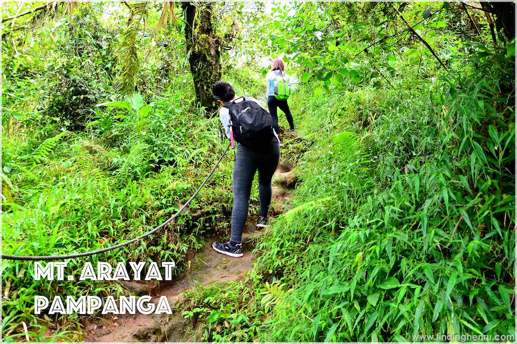
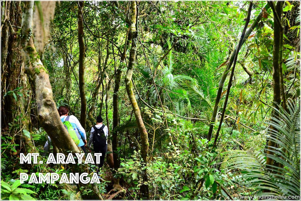
Resuming our hike, we are excited to again discover the rest of the mountain. From the North Peak, a steep descent towards the center of the 2 peaks. I am still in awe seeing the beauty of the forest in the area. There are portions passing through a ridge, not scary since it is forested.

Upon reaching the huge rock, our guide tells us to pose for the view. We each have our turn doing our signature pose while mesmerizing the remarkable view from the top. We are also extra careful since we can be dropped to the cliff if being out-balanced.
At the rock, there is a roped segment in going down the trail. It looks easy though, just be very careful because of the cliff on the side. However seeing our guide not holding onto the rope while assisting us only shows that it is that easy to do the rope.
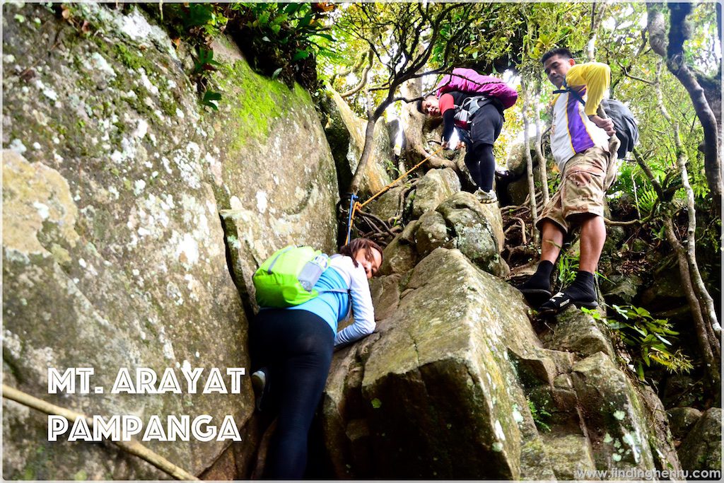
Continuing our walk, we come across an assault towards the South Peak. Now, there is a different trail wherein you will plainly follow the steep steps on the side. Thank God it’s not raining that I can just imagine the slippery slope will be quite challenging if ever.
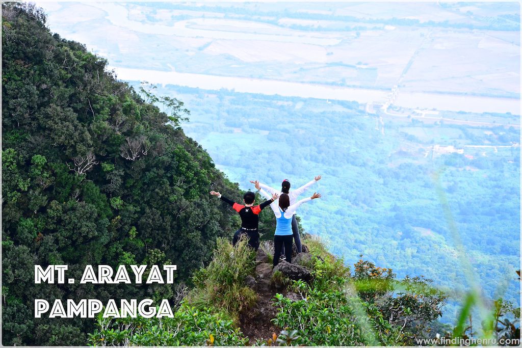
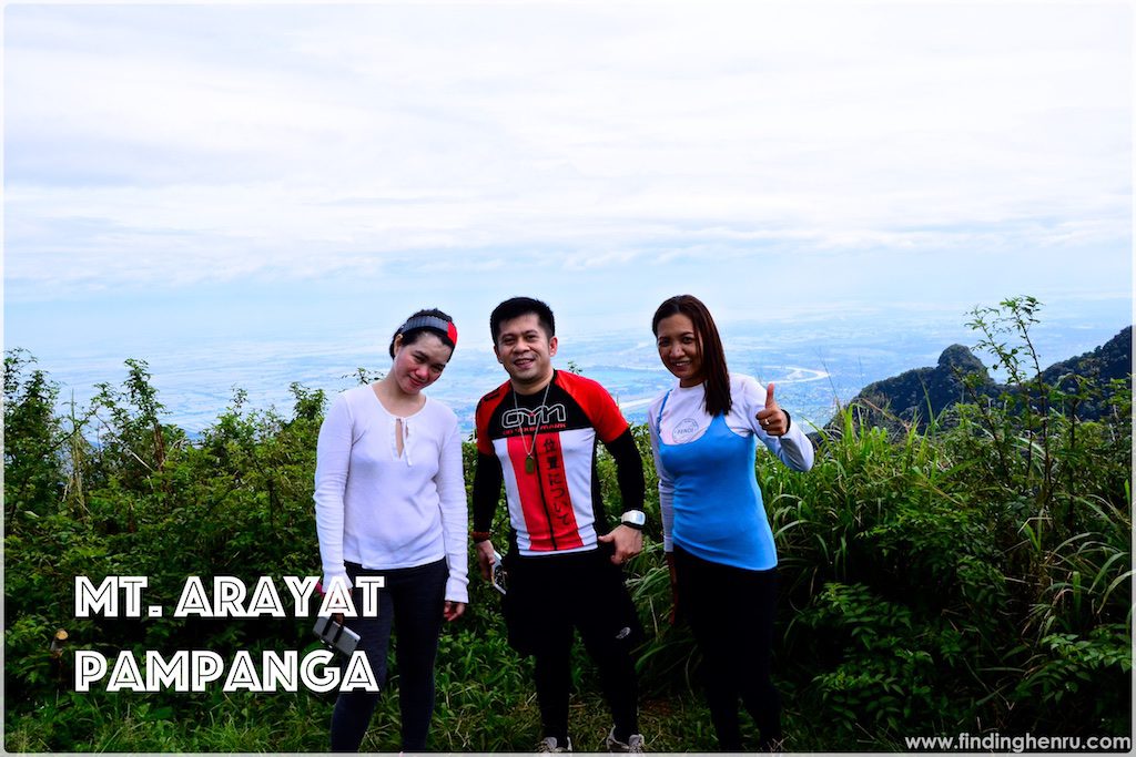
Arriving at the South Peak, we immediately look for the viewpoint. Our guide also suggests one good viewpoint just walking distance from the open area. He is right when telling us to go there since it offers a very good view of the place. Who will forget to do our signature poses for the view? We only have a quick photo ops in the place then we decide to start descend since it shows some signs of rain.

Since the trail is all going down, we are now faster targeting to reach the exit before dark. We only have one stop for a short rest and resume our trek down. Finally, we arrive at the registration area where we logout at 5:45pm.
Lucky for us to find a tricycle to take us back to the resort to freshen up. We have a quick dip at the pool and oh it is so refreshing. However, it is bothering to have big mosquitoes around so we decided to pack-up. We did not stay longer since we also plan to have dinner in Arayat.
Overall, the climb is amazing. It is all worth the time and effort. Thanks to Gladys for coming to climb with us. Thanks also to Philamer despite her tired work schedule, she simply says YES to us. Till our next BFF Climb.
With me:
- Philamer Pejo
- Gladys Jane Tapdasan
Climb Date: October 25, 2016
Latest posts by Henru (see all)
- 42KM @ 42 – Cebu City Marathon 2023, The CCLEX Experience - January 8, 2023
- BATAAN… Mt. Natib - June 12, 2017
- BENGUET… MT. PULAG (AMBANGEG TRAIL) - March 17, 2017