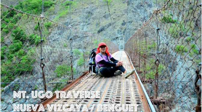
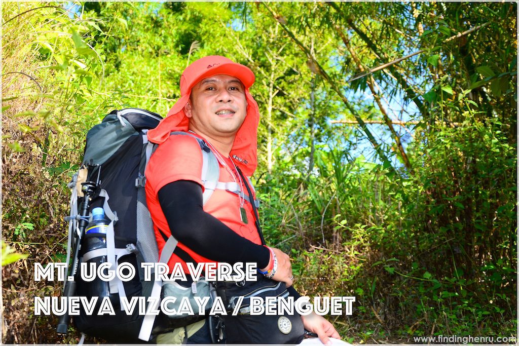
MT. UGO (2,150+)
Nueva Vizcaya and Benguet
Jump-off points: Kayapa, N. Vizcaya; Brgy. Tinongdan, Itogon, Benguet
LLA: 16.31916°N, 120.80166°E, 2130 MASL
Days required / hours to summit: 2-3 days, 9-10 hrs
Specs: Major climb, Difficulty 5/9, Trail Class 1-3
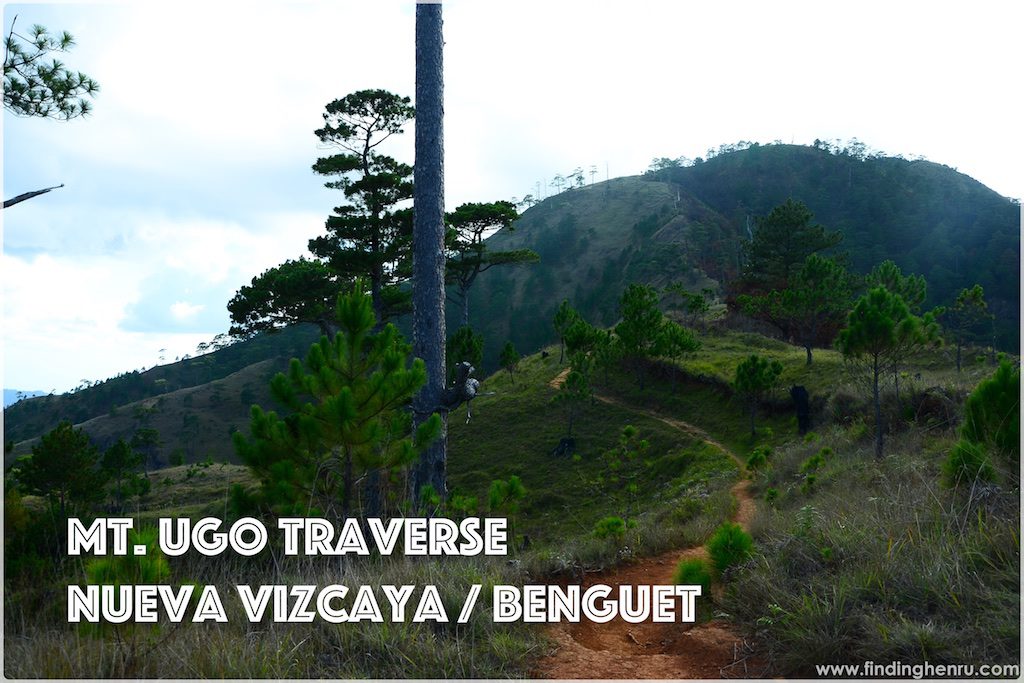
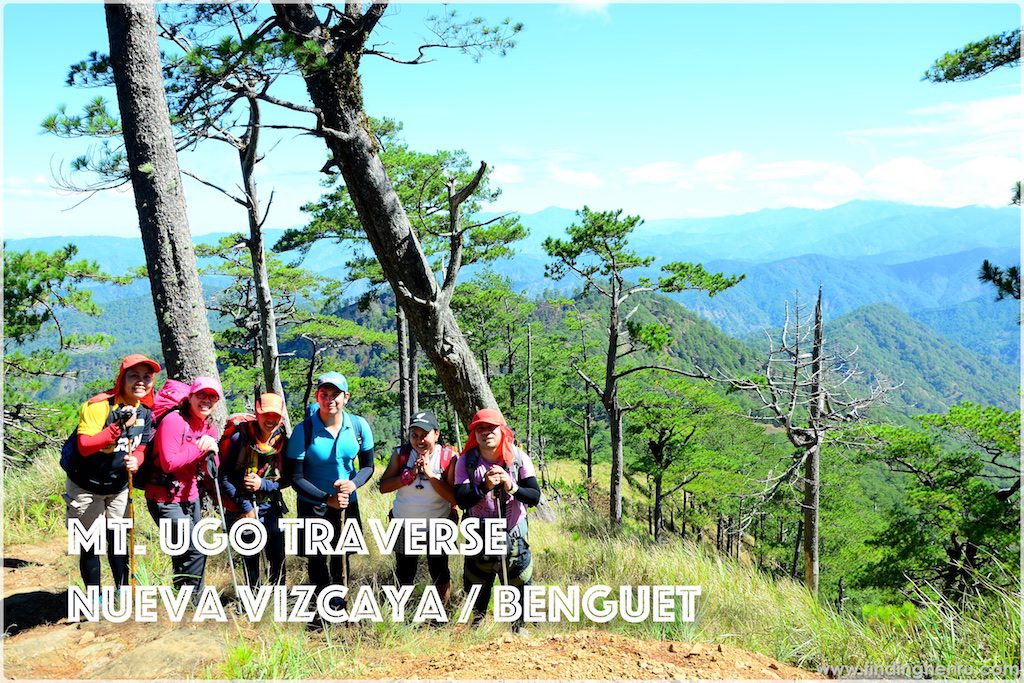
Features: Pine forests, highland villages, views of Cordillera peaks
*From Pinoy Mountaneer
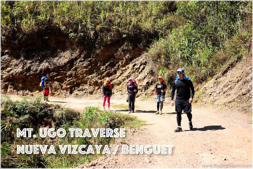
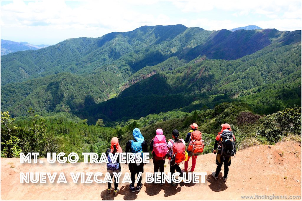
Mt. Ugo Traverse is one of the favorites of all hikers. It is classified as a major climb traversing from the Province of Nueva Vizcaya to the Province of Benguet. Most of the itinerary will start at Poblacion, Kayapa, Nueva Vizcaya and ends at Tinongdan, Itogon, Benguet. The total distance is a whooping 32 kms of various terrains and elevations.
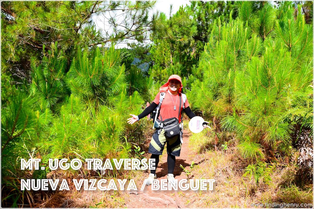
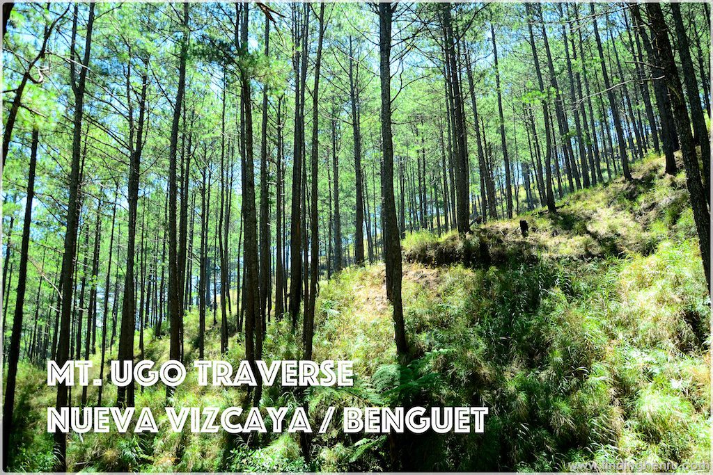
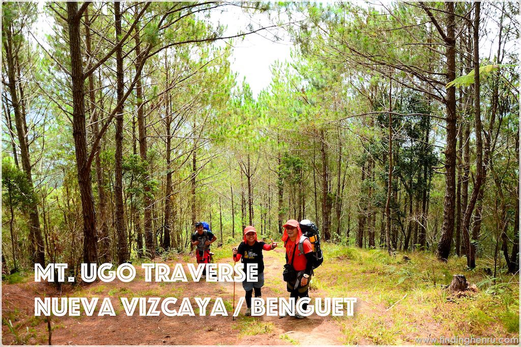
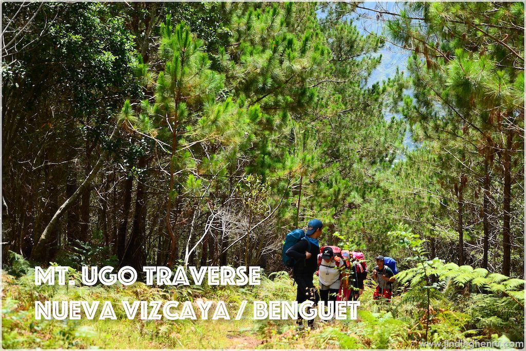
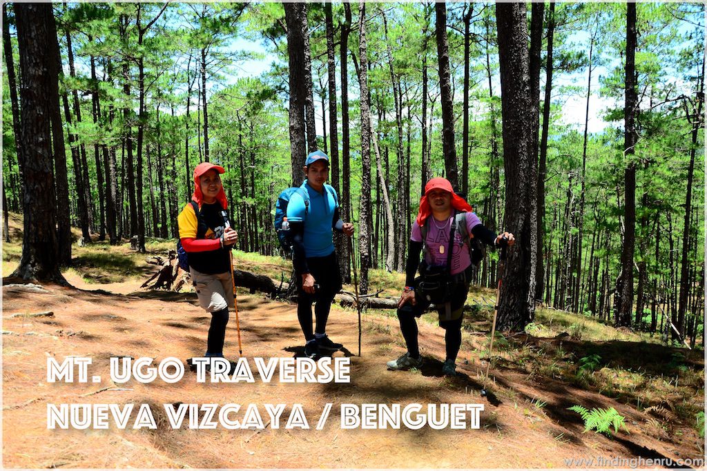
As usual, the trail of Mt. Ugo Traverse is well established. It is purely pine forest from start to finish, with open trails when walking on the dirt road. To better enjoy and appreciate the mountain, spending a night at the campsite is necessary.
When spending a night at the campsite, just make sure you have all the necessary gears with you. At night, the temperature drops beyond normal and wind chill may drop to negative. Everyone should prepare for this. While all hikers are after the sunrise and sea of clouds, Mt. Ugo is generous to that. Better prepare your camera to capture the best sunrise and sea of clouds you are looking for.
Day 1 is generally an easy 15kms hike except for the first 3-4hrs from jump-off where the trail is all assault of about 40-50 degrees. Also the last hour going to the campsite at near the summit, not classified as cardiac assault yet it is exhausting. After all day of walking then comes this last hour of steep climb, all energy left must be sufficient to reach the campsite.
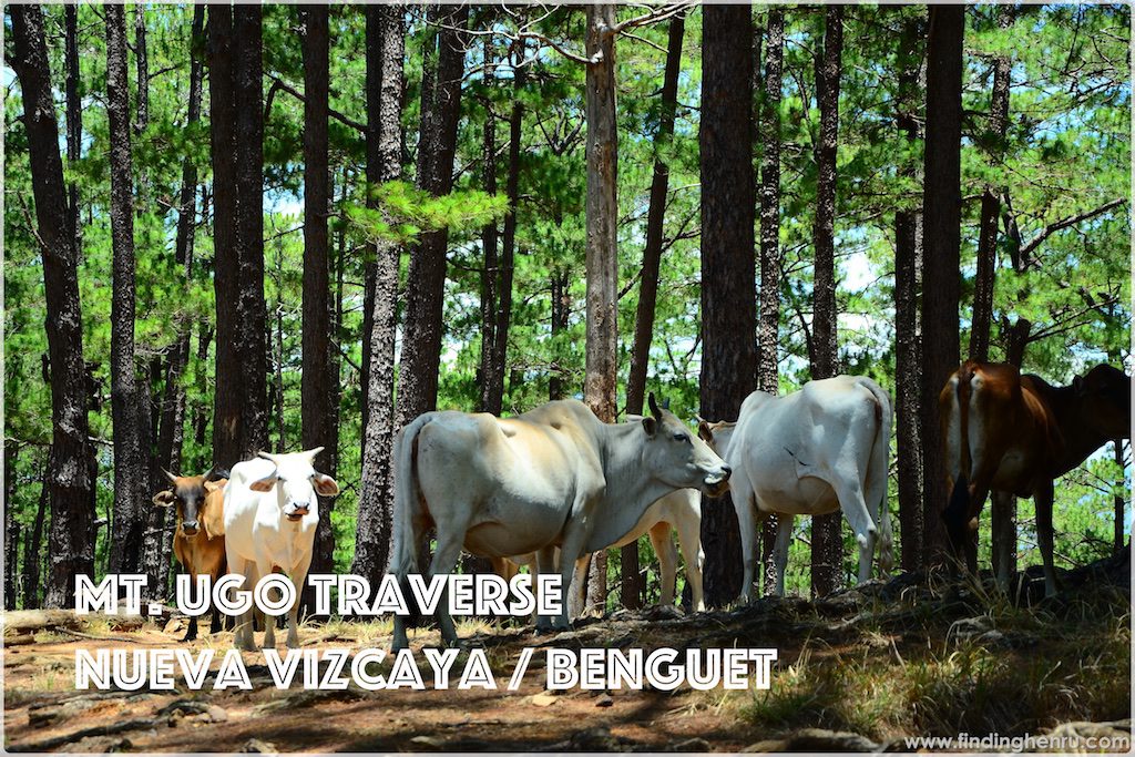
Caution to campers at the campsite; always keep your things secured. Sometimes there are wild cows roaming around and might eat whatever they will see at your campsite.
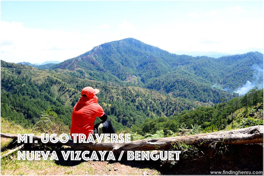
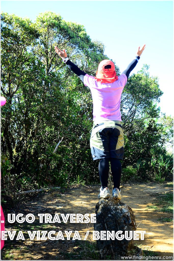
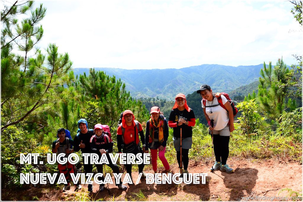
The summit is just 15 minutes from the campsite with the same view at the campsite. What’s special at the summit is that it has the border dividing the three provinces of Nueva Vizcaya, Benguet and Pangasinan. Mt. Ugo trail also came into existence due to the plane crash near the summit.
The trail from the summit going to Tinongdan is about 17kms long. All of which are pine forest. One will easily fall in love with the trail. It is established to not just for regular hikers but for trail runners as well. Several mountain running activities were held at Mt. Ugo trail.
The final end of the trail is the famous hanging bridge. Everybody is looking forward for a photo opportunity with the hanging bridge. It does not just mean the end of the trail, it simple marks success to every climber of conquering Mt. Ugo.
Itinerary
May 6, 2016
08:30pm – Meet up at Victory Liner Kamuning
09:00pm – Departure to Aritao, Nueva Vizcaya
May 7, 2016
05:00am – Arrival at CKQ Restaurant
05:15am – Meet up with Van Service and drive to Kayapa, Nueva Vizcaya
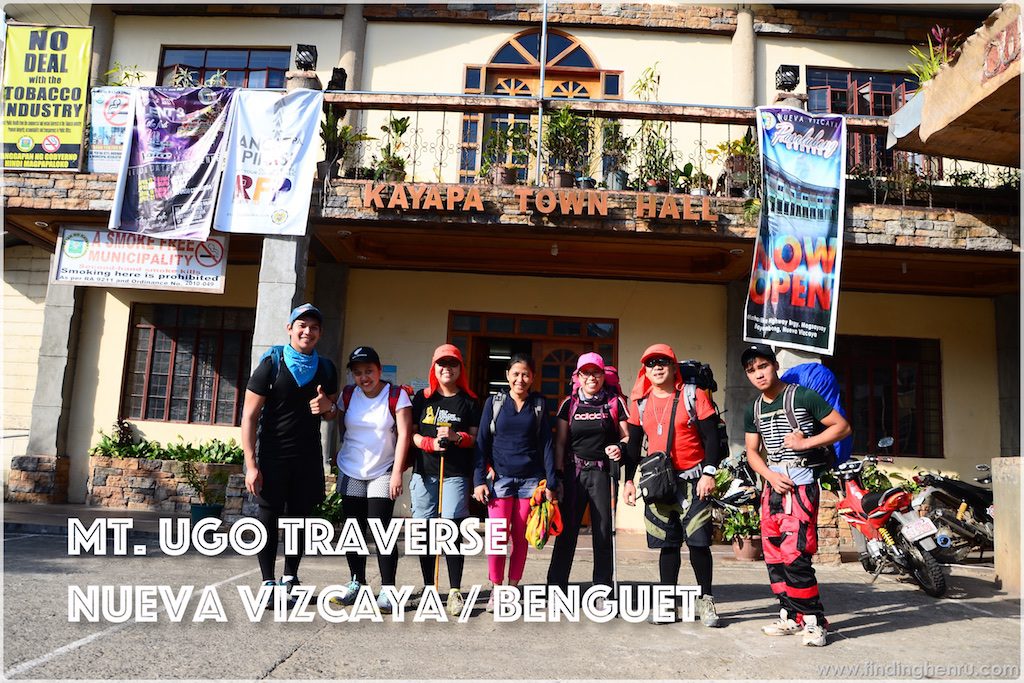
06:00am – Arrival at Poblacion, Kayapa, Nueva Vizcaya, meet up with guides and porter; breakfast at nearest carenderia and final packing of things.
07:37am – Start Trek
11:30am – Arrival at a Village: first water source and lunch
12:00nn – Resume Trek on an open road of maybe 10kms or more
02:00pm – Rest stop at a waiting shed, with Mt. Ugo as the background
04:30pm – Rest stop before the steep assault to campsite
05:45pm – Arrival at Campsite, fixed our tents and ground sheet, snacks while preparing dinner.
07:00pm – Dinner
08:00pm – Socials
09:00pm – Lights off
May 8, 2016
05:00am – Wake-up call for Sunrise, prepare for breakfast
07:00am – Breakfast, break camp and LNT
08:00am – Move out from Campsite
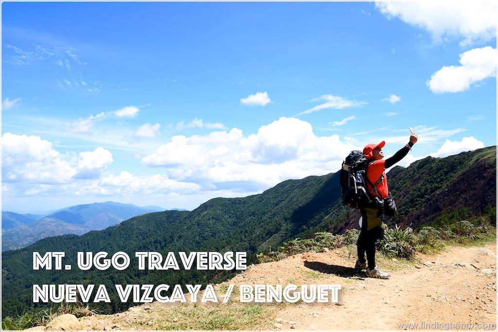
08:15am – Photo ops at Summit and the Provincial border
12:30pm – Lunch break at the KM7 village, rest for a while
05:00pm – Arrival at the Hanging Bridge, photo ops
05:15pm – Arrival at KM 0, van service takes us to Brgy. Hall of Tinongdan to claim the certificates and freshen up
06:00pm – Departure to Baguio City
08:30pm – Dinner in Baguio
March 9, 2016
12:10am – Departure to Manila
04:30am – Arrival in Manila
This climb to Mt. Ugo is not really planned. After our NatGeo Earth Day run, we are thinking of going outdoors. Bingkat and Maan are both actively searching for a destination and the come up with Mt. Ugo. We send several invites to friends and finally, 6 of us respond to it.
Good thing, we are all free on one long weekend in May, in time for the election, so we choose the dates May 6-9, 2016. Bingkat looks for contact numbers of the guides in Kayapa, arranges Van Service from Aritao to Kayapa and communicating with Brgy. Tinongdan Office for any queries we need. I also volunteer to reserve our bus tickets since it is a long weekend, expecting volume of passengers.
All is set. The final participants are Bingkat, Maan, Mia, Aisle, Meong and I. I have one extra ticket for Larry or Elvin who’s not coming and I just sell it to a chance passenger. The bus departs on time and arrives at Aritao, Nueva Vizcaya just in time too. Our van service is already waiting for us. It takes only 40 minutes travel time from Aritao to Kayapa and we arrive in Kayapa at 6am.
Our guides and porter are already waiting for us at the registration booth. While Bingkat is busy with the registration, we are also checking on things we will unload to our porter. Tents and other provisions will be for the porter, we also ask him to fetch us 5 liters of water using our collapsible water jug. As per agreement with our porter, he will find a good spot at the campsite and will be pitching our tents too.
At a nearby carenderia, we take our breakfast and secure our lunch. Oh we almost forget the Empe for the socials, my punishment is to carry it with me since our porter left already. When done, we have quick photo ops in front of the Municipal Hall of Kayapa before starting our trek.
To be exact, we start our trek at 7:37am. Actually, it is my first time to do this kind of activity carrying a big load. I just can’t imagine myself to sustain the climb. Since our minds are set at a chill climb and pace, we hold on to it and just laugh out the tiredness. The start of the trek is a steep stair climb. By the way, I quickly am exhausted. We keep moving and start walking along some small pine trees. Wow it’s beautiful.
Prior to the climb, an itinerary is set with a timeline into it. So far, we are still in line with the schedule. Moving along, the trail has amazing landscapes that we can’t help but take photos. We also do videos. I am happy to discover that my Smart signal has strong connectivity that I can post an update on our whereabouts and activities.
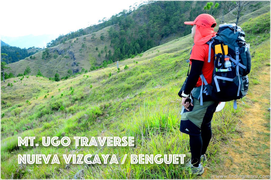
As we start walking along the pine slopes, more rest stops for all of us. The view is magnificent. Pine forest is stunning. While feasting on the view, all the tiredness immediately fades away. We still have long way to go and finally we reach the village at 11:30am. At the store, we take our lunch and savor the fresh wind blowing on to us. In addition, we also have a quick rest, restroom break or fetch drinking water for our trail.
At 12 noon, we resume our hike. It is no longer a trail but on a dirt road. We don’t know the exact distance of the dirt road but I guess it’s more than 10 kms. It is an open trail and only Bingkat has an umbrella. The hot sun on a mid-day adds a challenge to our hike. Good thing, it’s now a chill walk though.
After 2 hours of walking on the road, we arrive at a waiting shed on the other side of the mountain. This time, we are able to see Mt. Ugo and it’s still far. The road is still winding along the side of the mountain range connecting Mt. Ugo. We have a short rest stop at the waiting shed. They have one good viewpoint with one tree trunk laid on the grass. We all take the opportunity of posing there. My Smart connection is still strong and I am happy for it. I am live to the world.
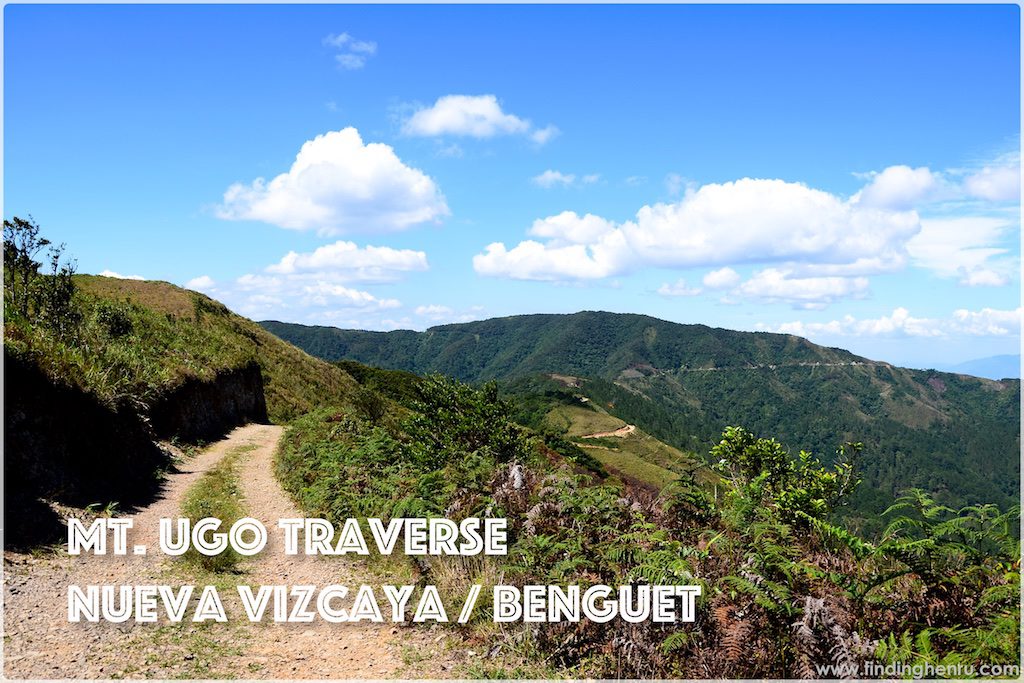
Gaining back our energy, we resume our hike. By the way, Aisle now is walking ahead of us. Her reason is that she walks slower than us and we will surely catch her along the way. Seeing Mt. Ugo from afar excites us to move further. Still we are walking at the dirt road, we are then thinking of hailing a jeepney to take us to the nearest access point of Mt. Ugo. Lol.
Before the end of the road, we are taking the short cut passing our way to the last water source. We can also see the school on our right side. By the way, some campers are also utilizing the school as campsite.
Its already 4pm and we are back at the assault portion of the trail. Just an easy assault passing along some smaller pine trees. From there, we can clearly see the winding road we are walking for the past hours. It’s simply amazing that we survive the distance. Now we are in a struggle to reach the campsite. At 4:30pm, we are at the start of the steep climb to the campsite.
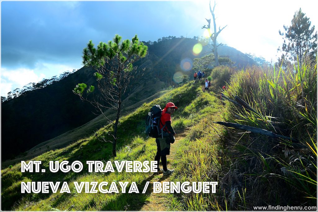
After exhausting all our energy on a long hot hike, we are now in quest on climbing a steep slope. I know that we are near the campsite. We are seeing the dead tree, which marks the campsite yet as we continue climbing, the more we feel the difficulty. I have enough load to push myself to reach the campsite. The struggle is real. I just keep moving, not minding my friends ahead of me. There comes a point that I want to surrender, I want to leave the bag and will just come back to get it when I regain my energy. Just keeping my mindset of just pushing even at my slowest pace, in the end; I will surely reach the campsite.
I feel like I spend a lot of time at the last assault, good thing we all reach the summit at 5:45pm. Our porter is waiting for us there. Two of our tents are already pitched. And gardenia feast is waiting for us. Meong makes our coffee while Maan and Aisle pitch their tent.
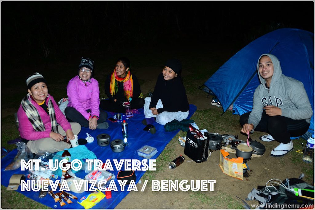
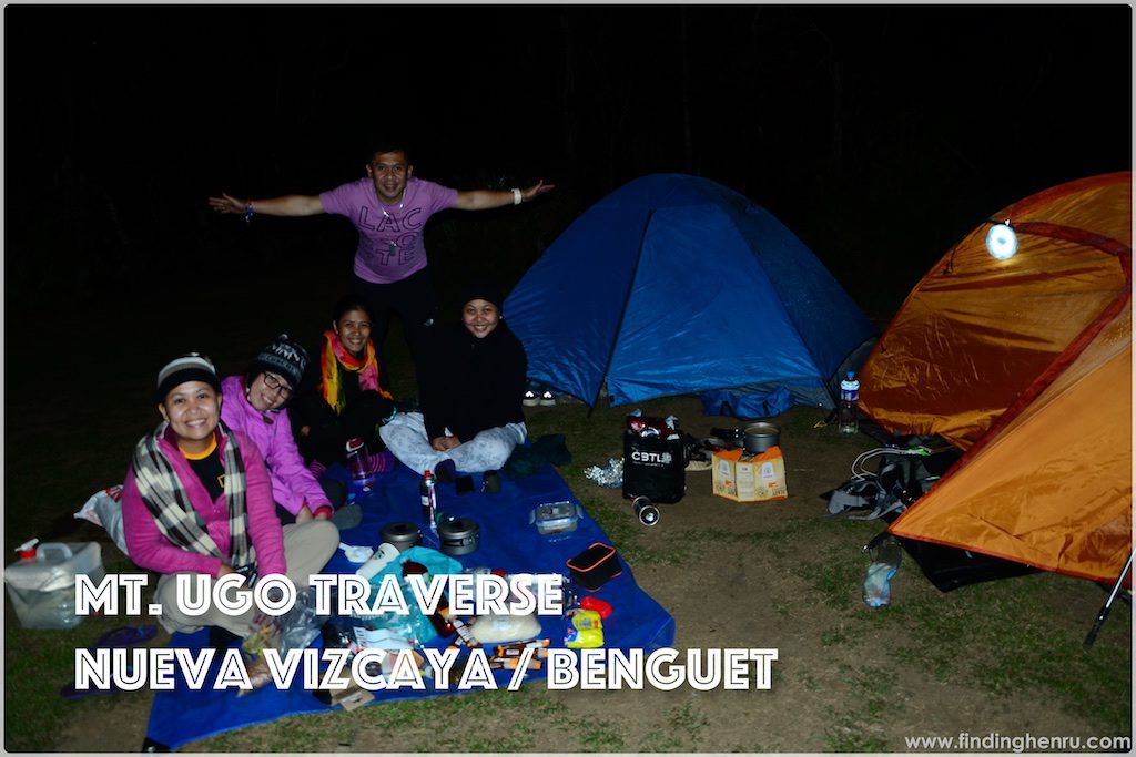
Back with our smiles, we prepare our dinner. I have pre-cooked adobo while Maan have longanisa too. Two stoves are working, one is cooking rice and the other is re-heating our pre-cooked food. At 7pm, dinner is ready. Bon apetite!
We are done with our dinner, now we are getting ready for our socials. My additional 1-liter of load is finally off me and we are about to enjoy Empe Lights. No usual topics, we just enjoy and laugh about what happen on the trail. Since it is still early, the temperature is still manageable. Oh by the way, when reaching the campsite, our guide tells us that we will be with another group of climbers at the campsite. While having dinner, we are wondering where is the other group. Now while having our socials, the other group is not there yet. We simply assumed they have set their camp at the school or somewhere else. While having our socials, we own the campsite to ourselves.
We are not that heavy drinker that we finish after an hour. It maybe late already yet the temperature is still manageable. Since we are thinking to be the lone group at the campsite, we are securing our things so when the wild cows come to visit, they cannot find anything attractive to consume. Finally, lights are off at 9pm.
Three tents are available to us; one from Mia, the other from Bingkat and the third one is from Aisle. I sleep with Bingkat, Meong with Mia and Maan with Aisle. Aisle’s tent is bigger so if in case we are seven, we still have enough to accommodate.
After lights off, I stay at Mia’s tent to chat with them. We play some songs from my play list using Meong’s Bluetooth speaker. 30 minutes later, I transfer back to our tent to finally call it a day.
At around 11pm, I am awaken by Maan’s voice saying that there are people coming. And that is the second group to stay with us at the summit. I am hearing their voices while making their camp and fall asleep afterwards. At 1:30am, I want to pee so I go out of our tent in shirt and pants only; I am not wearing my jacket. I am thinking that the other group is already okay but they are not. They still are pitching their tents. I am thinking, what the… they are still working at that very hour instead of just resting and it’s cold. They are big group though, that’s the reason why.
Before going back to our tent, I inspect our trash and other belongings when suddenly I feel the chill inside me. I immediately grab my jacket and go back to our tent. Checking on the temperature, it is 11 degrees yet maybe the wind chill is close to zero or even negative. At first, I am not using my jacket and sleeping bag, this time I need to use it to take away the chill in my body. It makes me awake for a moment until I am back at my normal body temperature.
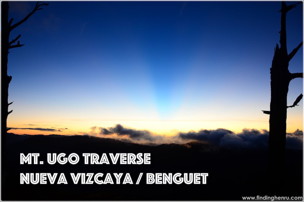
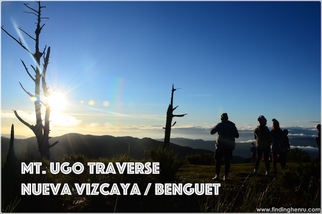
Aisle set her alarm at 4:30am, she is trying to wake me up and I am not responding. At 5am when the sun is about to shine, she’s persistent to wake us all up to witness the sunrise. As we are noisy and busy, one group of hikers arrive to witness the sunrise, I believe they set their camp in school.
While waiting for the complete sunrise, we are also sipping our coffee. After taking photos with the sunrise and sea of clouds, we are preparing for our breakfast. Spam and the rest of the longanisa for breakfast, then we are also cooking rice for our lunch. I have the second batch of adobo and dividing it to us for easy unpacking during lunch break. At 6:30am, we have our breakfast.
Our guide arrives early as the agreed move out is at 7am, this time we are an hour behind schedule as we are just breaking camp at 7am. Final move out is at 8am. The other group is still busy cooking their breakfast too.
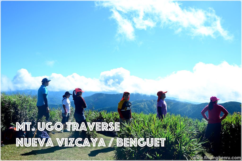
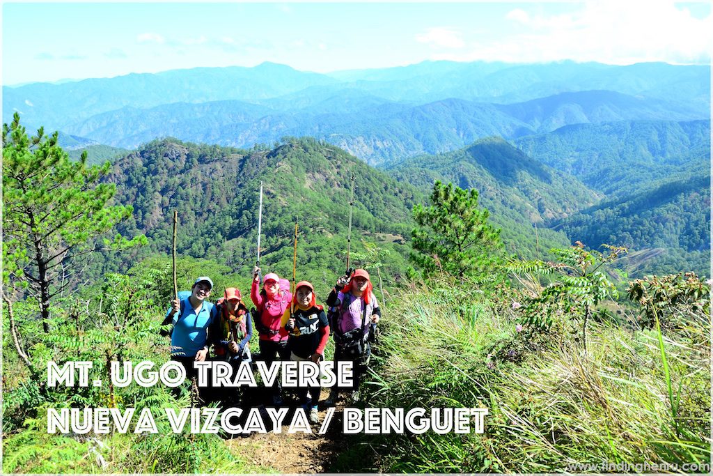
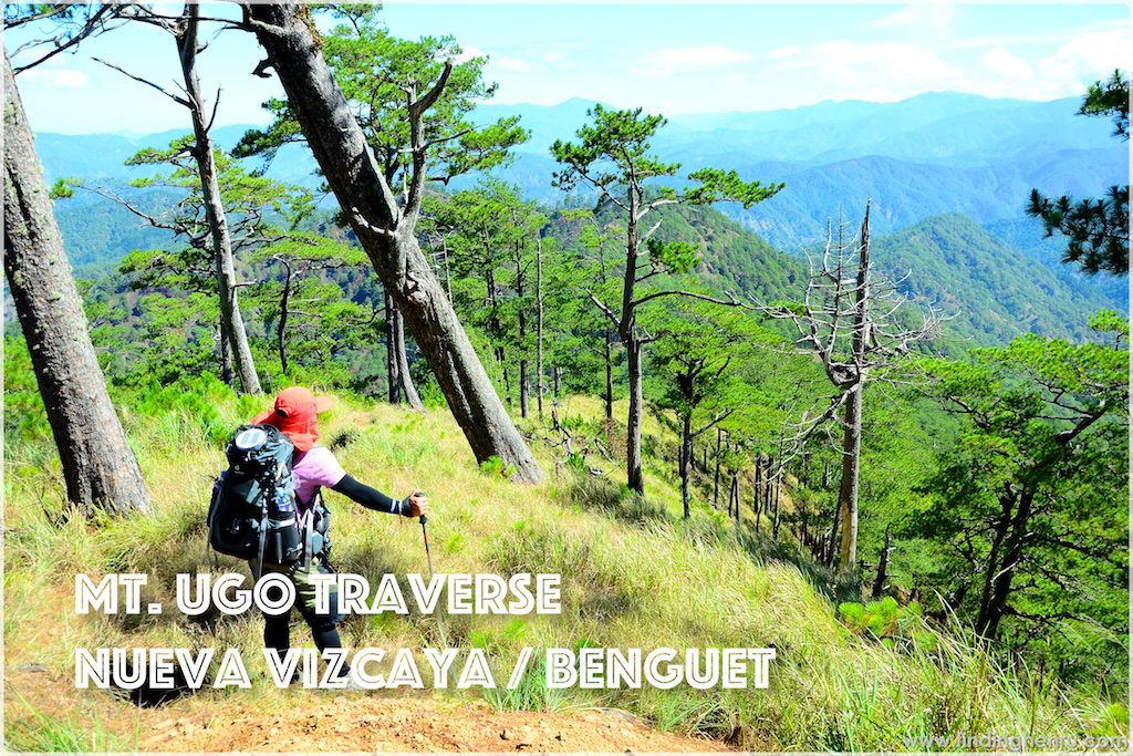
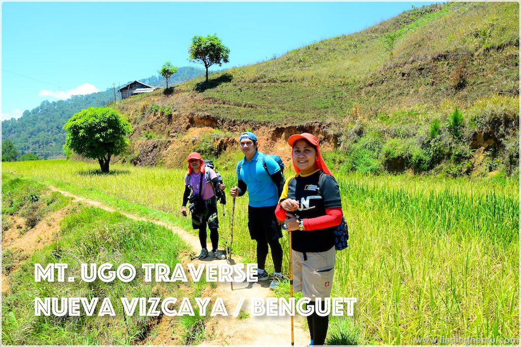
At the summit, it’s all ours again. We have a chance to pose one by one at the border of the three provinces. And after a while, we proceed with our hike down the grassland. Now we have a wonderful view of the other side of Mt. Ugo, the Benguet side of it. Baguio City is visible from afar. All the scenes are pine trees and its spectacular.
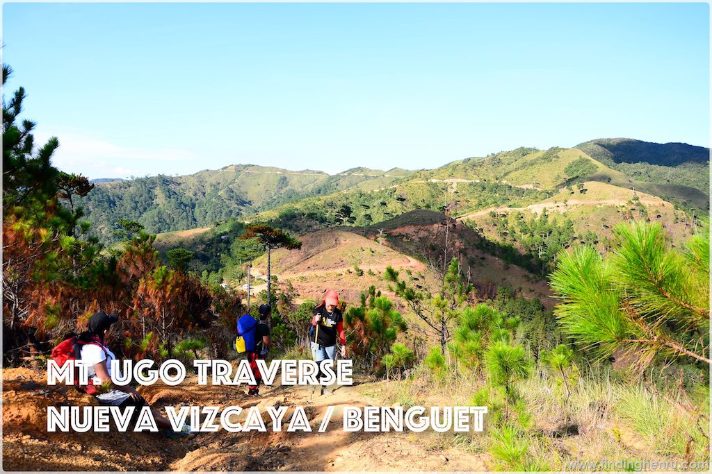
Since we come from the summit, we are expecting the trail to be all descending. Though there are portion of an easy climb yet generally, the rest are descending. Pine forest is spectacular. We are literally walking along the slopes of pine forest and its impeccable. There are sightings of wild cows along the trail, they are harmless though. There is one chance that we take pictures with the cows.
At one portion of the trail, I got disappointed with the burning of the grass and trees. The reason as per our guide, it enables new sets of grass to grow for the wild cows to feed on to it. Still I don’t buy the reasoning. We are walking 10kms before reaching the village for lunch at 12:30pm.
Short rest stop at the village, I also get the chance of a restroom break. Refreshing ourselves at the faucet available on the side, that really helps a lot. At 1:30pm, we resume our trek. Again we continue with the rest of the pine forest then suddenly the trail is getting a little steeper with loose rocks on it. We can’t help but run into it.
It’s still a long way ahead. The course remains the same, steep descent plus loose rocks and now with a cliff on one side, we should be very careful. This is now a different struggle until we reach Km 3 where we have another mountain dew break. Km3 is now reachable by vehicles but we cannot do it since we will miss the hanging bridge at the end of the trail so we continue with hiking the remaining distance.
Before reaching Km1, we have these sightings of the river and flat grounds. Km 1 is the flat ground and there is one store right after the rocky trail. Another mountain dew break, a thirst-quencher for a tiring walk.
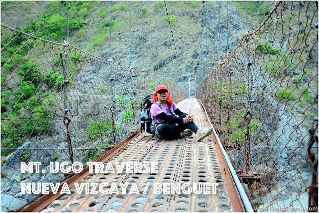
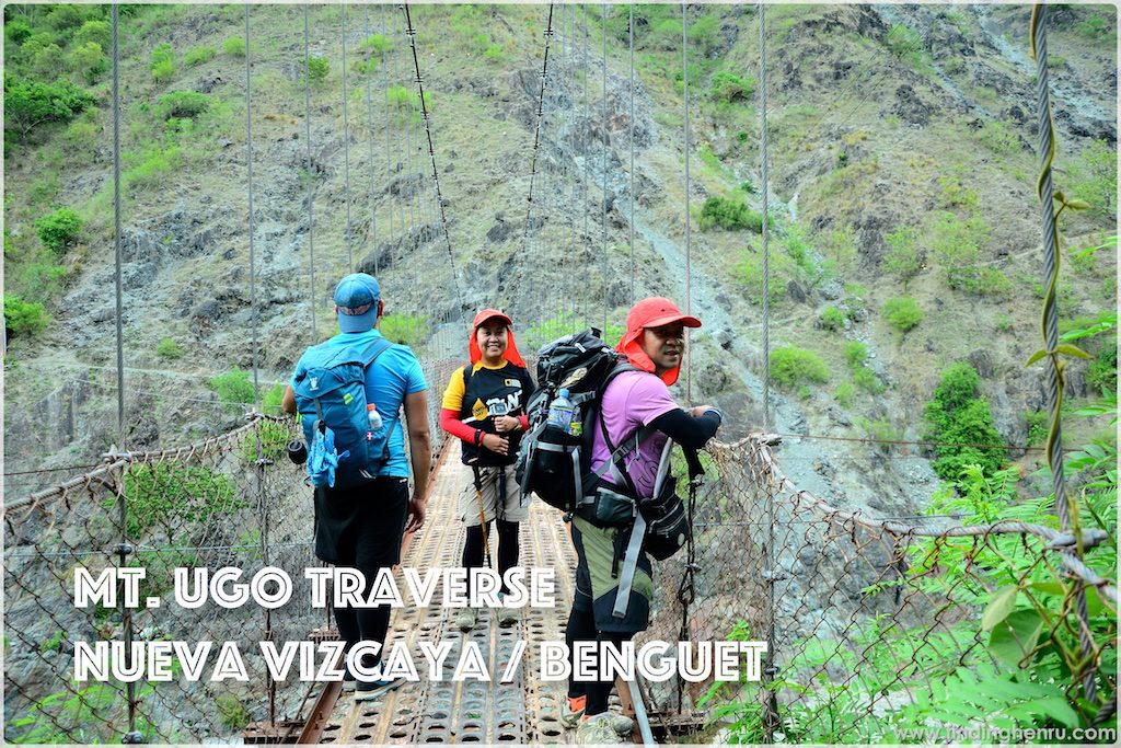
Continuing our walk, we reach the hanging bridge at 5pm. We are thankful to have the bridge to our own. The bridge is picture perfect to have it to us only. Bridge location is just 500 meters away from KM 0 so we cannot wait to get there and finally take some rest. At 5:15pm, we are all complete at KM 0.
After settling our bills with our guides and porters, the van service is already waiting for us to take us to the Brgy Hall of Tinongdan for our certificates. We also used their bathroom to freshen up. At 6pm, we leave for Baguio City.
Along the way, the van’s rear door is open and unfortunately, Aisle’s tent is missing. We try to go back and trace where it falls, we no longer see it on the road. Maybe somebody already got hold of it. So we proceed to Baguio and arrive at Victory Liner at 8pm. We leave our things at the guards and walk our way to Session Road for dinner.
Our bus ticket is at 12:10am so we just wait for our departure. Comes the time to board, we immediately do it since we all want to sleep. All of us are asleep along the way and wakes up only after the bus conductor shouts for those who will drop at Cubao Terminal. That’s as early as 4:30am, that’s how fast our trip back to Manila.
Overall, the climb is fun and enjoyable. This may not be possible without these superb friends of mine. From organizing our trip to the actual event, no dull moments. We really are creating memories worth to be treasured. Back to the trail, easy or hard, we still are painting smiles on our faces. We still manage to laugh at the difficulty. With all the aching feet, everyone is still excited to tell a story about our climb. It really is that memorable.
With me:
- Mia Coyme
- Bingkat Movera
- Maan Delica
- Aisle Mandadero
- Meong Gamboa
Climb date: May 7-8, 2016
Latest posts by Henru (see all)
- 42KM @ 42 – Cebu City Marathon 2023, The CCLEX Experience - January 8, 2023
- BATAAN… Mt. Natib - June 12, 2017
- BENGUET… MT. PULAG (AMBANGEG TRAIL) - March 17, 2017
I love Cebu, El Nido, Boracay and Bohol. When I retire, I will be living on one of these beautiful islands.
thank you for loving the Philippines…
The Philippines should be labeled the summer capital of the world! There’s just soo many beautiful placed to go and visit during the summer.
thanks, you should visit Philippines more often